Ten Years of a Success Story in Lebanon
Szöveg: Capt. Sándor Kisgyörgy | 2016. november 1. 10:48It will be ten years in November that Hungarian peacekeepers have been serving with the UNIFIL mission in Lebanon.

Lying on the eastern coast of the Mediterranean Sea with an area of more than 10,000 square kilometers, Lebanon has a history rich in conflicts and wars. The United Nations Organization has been present in the country since 1948. By resolutions 425 and 426, the world organization established in 1978 the United Nations Interim Force in Lebanon (UNIFIL), which had a strength of 3000 until 2006.
In 2006, after a 34-day conflict between Lebanese Hizbollah and the Israel Defense Forces (IDF), the UN adopted resolution 1701 under which it increased the troop numbers of UNIFIL and extended its area of operations so that the mission can implement its mandate. The UN urged its member states to make troop contributions to UNIFIL, now enhanced in number. The government of Hungary declared some small specialized units to the mission, of which the UN requested the geographic information service (GIS) support component.

Hungarian peacekeepers have been serving at the UNIFIL HQ in Naqoura since November 2006. Over the past ten years, 25 soldiers from 12 units of the Hungarian Defence Forces have done their tour in the mission in yearly rotations.
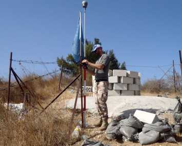
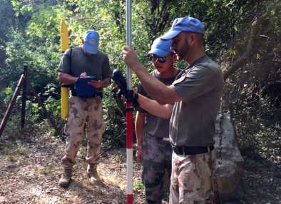
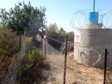
The Hungarian GIS specialists take part in every task that requires geoinformation support for the conduct of peacekeeping operations in Southern Lebanon. Their special duties are to determine the points of the Blue Line separating Lebanon and Israel, to supply the troops with paper-based and digital maps and to hold general and trade training events. Further tasks of the Hungarian GIS specialists include provision of mapping support to investigation teams responsible for establishing technical details of incidents in the area of operations.
In addition to the above, keeping up with the advance of 21st century technology, the Hungarian specialists have actively participated in the development of several geoinformation applications, which are a great help to the peacekeepers deployed in Southern Lebanon.
